Geographic constraints often determine how effectively states can convert national power into strategic influence. Control of critical transit corridors, maritime routes and future space infrastructure may shape security outcomes more than aggregate military strength alone.
Lessons From Ancient Strategy
Thermopylae is remembered as one of history’s great last stands and has been the subject of films, novels and comics. King Leonidas and his small Greek force (often remembered as “the 300”) could not stop the Persian invasion of 480 B.C., but the pass’s importance was never based on whether it could be held. The resistance imposed costs and bought time. The simultaneous naval fighting at nearby Artemisium, often forgotten in popular accounts, showed that the land and sea campaigns were linked. The loss of Thermopylae forced the Greeks to confront the harder strategic question of what could be defended and what would have to be sacrificed.
Athens itself was abandoned. Its population was evacuated, and the city fell to the Persians.
Years earlier, however, Themistocles had prepared the instrument that would make a different outcome possible. He persuaded the Athenians to spend the revenue from their silver mines at Laurium on a large fleet, citing the immediate threat from Aegina rather than relying on warnings of a future Persian invasion. When Xerxes arrived, Themistocles fought another political battle to hold the divided Greek coalition together. Finally, through deception, he lured the Persians into the confined waters around Salamis, where the invaders’ numerical superiority counted for much less.
Salamis worked because a price had already been paid at Thermopylae, because Athens was willing to sacrifice the city rather than the means of continuing the war and because the fleet that would defeat the Persians was a result of Athenian strategic foresight, built before the crisis reached its climax.
The enduring geopolitical lesson is larger than the familiar observation that chokepoints matter. Geography can prevent a superior power from converting its total strength into usable force. But geography does nothing by itself. Strategic advantage comes from understanding it, preparing beforehand, recognizing what must be defended and what can be sacrificed, and concentrating effort where an adversary’s advantages can be diminished. Geography provides the opportunity; statesmanship recognizes what to do with it.
That relationship remains visible across the contemporary strategic map.
Geopolitical Chokepoints and Modern Conflict
Geography and asymmetric power
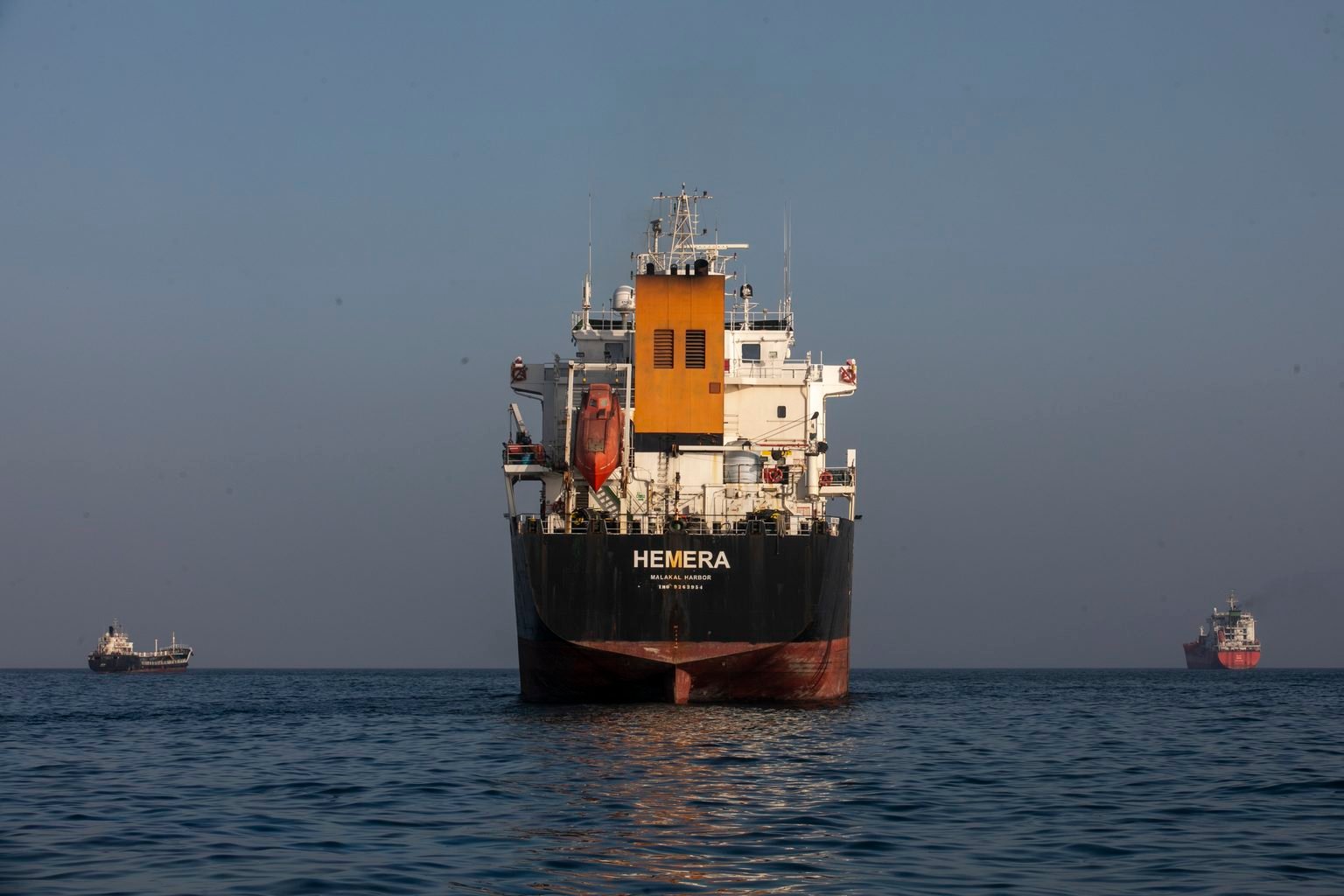
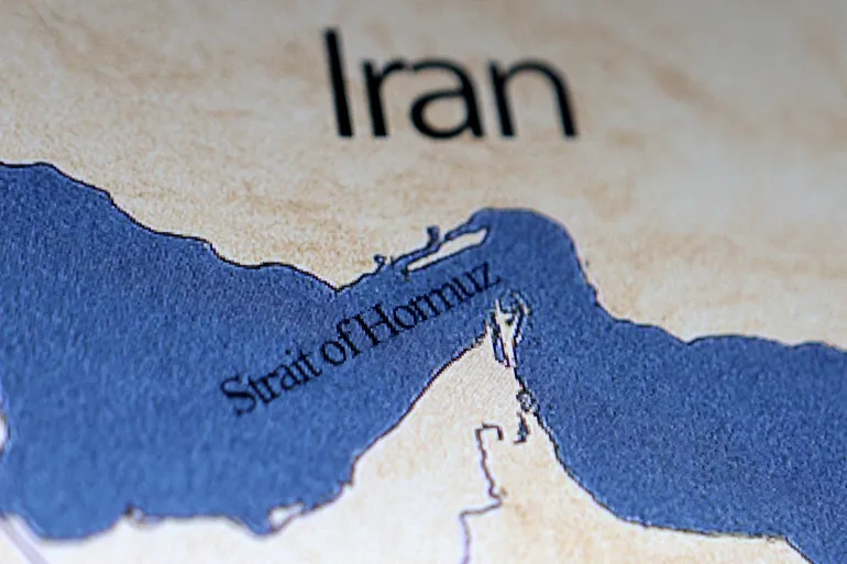
The Strait of Hormuz provides perhaps the clearest modern example. Iran cannot match the conventional naval power of the United States, but it does not need to. The narrow outlet of the Persian Gulf concentrates an enormous share of the world’s energy trade in a small area. Mines, missiles, drones, submarines and small craft therefore give Tehran the means to impose economic and military costs far beyond what a simple comparison of Iranian and American power would suggest. Tehran has put this capability to effective use in the war that began in late February.
Fighting around the Bab el-Mandeb Strait demonstrates a related principle. Houthi attacks on Red Sea shipping have forced commercial vessels to reroute and major military powers to spend heavily protecting maritime traffic. Ships avoiding the Red Sea and the Suez Canal can sail around the Cape of Good Hope, but at the cost of added distance, time and fuel. A relatively weak actor can therefore sway global commerce because geography magnifies the effect of inexpensive weapons.
The Strait of Malacca presents the problem from the opposite direction. China has become a great power, yet its strength is constrained because much of the commerce and energy sustaining it must pass through waters Beijing does not control. China’s longstanding concern with its “Malacca dilemma” reflects an elementary strategic reality: Growing national strength does not necessarily reduce geographic vulnerability. In some circumstances, economic growth raises the cost of disruption.
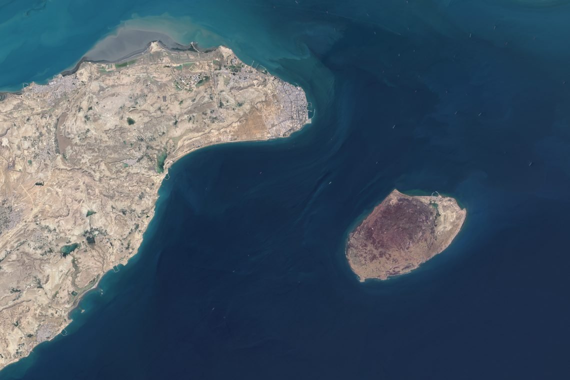
Hormuz, Bab el-Mandeb and Malacca are narrow waterways, as were the straits at Salamis. But strategic chokepoints need not be.
During the Cold War, NATO devoted extraordinary attention and resources to the Fulda Gap. There was nothing inherently valuable about this stretch of German territory. Its importance came from the interaction of terrain, political boundaries, military technology and Warsaw Pact force structure, which made it a likely avenue for a Soviet-led armored offensive toward the heart of West Germany. When the Cold War ended, the terrain remained, but its strategic importance all but vanished.
The Greenland-Iceland-United Kingdom (GIUK) Gap represents still another form of strategic constriction. The waters separating these landmasses are hardly comparable to the Strait of Hormuz. Rather, their significance comes from the ability to detect, track and potentially intercept Soviet, and now Russian, naval forces moving from northern waters into the Atlantic.
Chokepoints, in other words, can concentrate commerce, military movement, communications, surveillance or access. Narrowness alone does not determine their importance. It results from the interaction of geography, technology, political objectives and the capabilities available to exploit them.
The Indo-Pacific test
Nowhere is this interaction more consequential than in the Indo-Pacific region.
The Taiwan Strait is only one part of a larger strategic geography extending along the First Island Chain. Japan, Taiwan and the Philippines form a line of barriers and passages between the Asian mainland and the wider Pacific. The Korea Strait, the Miyako Strait in the Ryukyus, the waters around Taiwan and the Luzon Strait, including the Bashi Channel, consequently matter beyond their physical dimensions.
China and the U.S. have opposite geographic problems. China possesses enormous aggregate military power, but its naval and air forces seeking access to the wider Pacific must move through or over a limited number of passages. The U.S. and its allies, for their part, must project and sustain forces across enormous distances while protecting bases, logistics and communications that China can increasingly threaten.
Taiwan is therefore more than an island at the center of a sovereignty dispute. It is a geographic nexus whose location affects access to the western Pacific, the security of Japan and the Philippines, maritime commerce and the strategic positions of both China and the U.S.
This does not make Taiwan a clone of Salamis or the First Island Chain a 21st-century Thermopylae. Historical analogies become dangerous when resemblance becomes a substitute for strategic analysis. The continuity lies instead in the strategic questions political leaders must answer.
Questions Leaders Cannot Avoid
Where can superior power actually be employed? Where can movement be constrained? Which positions are indispensable? Which can be surrendered? Where can a weaker actor impose disproportionate costs? What price can prudently be paid today to preserve the possibility of victory tomorrow? And what capabilities must exist before the crisis begins? These were questions for Themistocles. They remain questions for today’s leaders, and they will follow human activity beyond Earth.
From geography to astrography
For most of history, geopolitics concerned the relationship between political power and terrestrial geography. Technology repeatedly altered the significance of geographic features without eliminating geography itself.
Human expansion into the Earth-Moon system is beginning another transformation. Geography becomes astrography. Geopolitics expands into astropolitics, and geostrategy into astrostrategy.
The terminology matters because space should not be treated as terrestrial geography at higher altitude. At first glance it appears to be the opposite of a chokepoint: vast, three-dimensional and seemingly without narrow passages. Yet strategically useful movement through space is far from unconstrained. Orbital mechanics, energy, time, communications, launch capacity and logistics limit practical choices.
As infrastructure expands, particular locations, pathways and systems may acquire disproportionate importance.
The Earth-Moon Lagrange regions offer one example. Their gravitational characteristics can make particular locations useful for observation, communications, staging and transportation. Near-rectilinear halo orbits are already important to plans for sustained lunar operations. The lunar South Pole has attracted attention because of its illumination conditions, potential access to water ice and the requirements of future exploration and settlement.
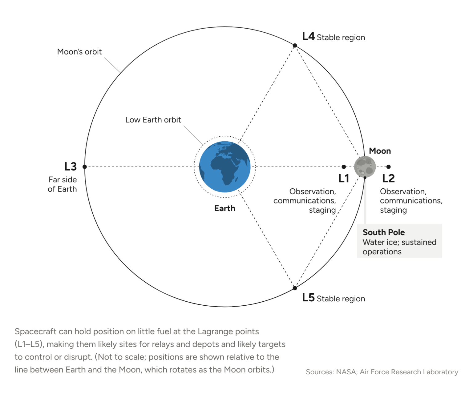
None of these equate to a Strait of Hormuz in space. The strategic principle is nevertheless recognizable.
As communications relays, navigation systems, fuel depots, transportation networks and other infrastructure emerge, humans will create dependencies on particular systems and locations. Astrography becomes astropolitically important when human purposes transform physical characteristics into opportunities, dependencies and vulnerabilities.
Geopolitical Chokepoints Beyond Earth
If and when the first genuine lunar war occurs, likely decades from now and in circumstances impossible to predict, its commanders will operate in an environment Themistocles could scarcely have imagined. But their strategic questions may be considerably more familiar. Those commanders will inherit decisions made long before the conflict begins.
Themistocles could not have built his fleet on the eve of Salamis. The ships, sailors and maritime culture required for victory had to exist beforehand. A society accustomed to thinking of itself principally as a land power had to accept a maritime strategy before the necessity of doing so became obvious to everyone.
Future leaders will similarly be unable to manufacture launch capacity, resilient constellations, cislunar communications, navigation, logistics, trained personnel and industrial depth once a crisis has begun.
The first lunar war, should it come, may therefore be shaped as much by decisions made years before the fighting as by the commanders who fight it. That is where Thermopylae and Salamis retain their relevance.
The maps available to future leaders will extend far beyond those known to Themistocles. Their obligation to understand them will not.
Scenarios
Most likely: Adaptation without escape
Great powers will increasingly recognize their dependence on geography and, eventually, astrography. They can attempt to reduce vulnerabilities they cannot completely overcome. China, for example, will continue developing alternatives to its dependence on Malacca while strengthening its ability to operate through the First Island Chain.
The U.S. and its allies will disperse forces, increase logistical redundancy and secure access to strategically important positions. The same process will begin in space as economic and military activity moves farther into the Earth-Moon system. Astrography can impose its own tyranny. Earth-Moon Lagrange regions, particular orbital regimes and access to valuable lunar locations may not resemble terrestrial straits, but dependence on them will produce the same disparity between aggregate power and usable power. The major spacefaring states will therefore seek redundancy and resilience, but they will not escape the fundamental problem: Their forces and infrastructure must still move through, depend on and operate from strategically important places.
Less likely: Cislunar chokepoints become targets
Iran’s exploitation of the Strait of Hormuz and Houthi attacks around the Bab el-Mandeb show what happens when weaker actors recognize that geography can compensate for deficits in total strength. Drones, mines, missiles and autonomous systems make it possible to threaten costly ships and commercial traffic without matching the navies protecting them. Cheap offense may be a better investment than expensive defense.
Something similar could eventually emerge in space. A state unable to match an adversary across the entire space domain might instead concentrate on the relatively small number of systems on which movement and sustained operations depend.
Communications relays, navigation architecture, launch facilities, orbital transfer infrastructure or future cislunar logistics could come to perform the strategic function of a narrow strait. The first serious contest over cislunar space may therefore be decided less by who possesses the most spacecraft than by who understands where an opponent’s spacepower becomes dependent and vulnerable.
Unlikely but high-impact: The first great chokepoint crisis expands beyond Earth
A prolonged closure of, or military contest over, Malacca or the passages surrounding Taiwan could reorganize energy flows, manufacturing networks, shipping routes and military deployments. A major-power conflict centered on Taiwan would also almost certainly have a space dimension. Satellites supporting communications, navigation, intelligence, targeting and warning would make the terrestrial and space theaters increasingly difficult to separate. A conflict that exposed vulnerabilities in these systems could fundamentally alter how the major powers approach cislunar development. Rather than reproducing the highly concentrated infrastructure on which terrestrial globalization came to depend, states could begin constructing rival and increasingly militarized systems of communications, navigation, transportation and logistics extending from Earth orbit toward the Moon.
The result would be astrostrategy in earnest: political actors deliberately shaping and contesting astrography before the first lunar war makes its importance unmistakable.